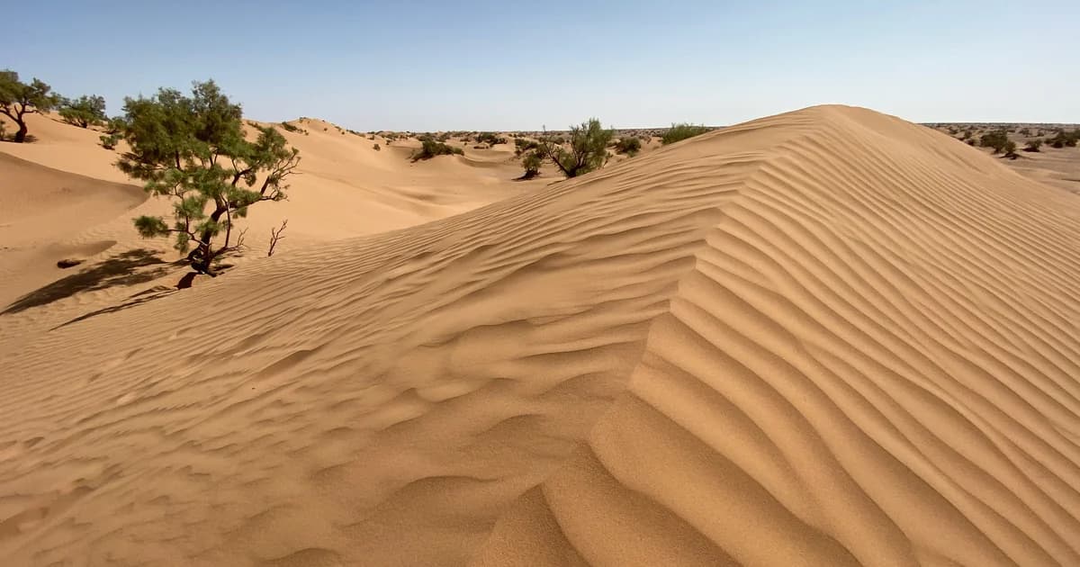

M’Hamid El Ghizlane is an oasis settlement in southeastern Morocco, in Zagora Province and the Drâa-Tafilalet region. The local International Nomads Festival places it at the end of the N9 road, beyond Tamegroute. It describes both an older settlement and a newer centre beside the Drâa. Festival introduction
That is a better starting point than a photograph of dunes alone. An introduction to M’Hamid should leave room for cultivated ground, homes, music and the people who make a life here. The desert belongs in the picture, but it should not fill the whole frame.
At a glance
- M’Hamid lies at the southern end of the Middle Drâa’s chain of oases.
- Its older settlement, M’Hamid Bali, and newer centre, M’Hamid Jdid, are distinct parts of the place.
- Cultivated fields, palms and earthen buildings belong in the picture alongside sand.
- Rokba is among the region’s documented musical traditions; water scarcity and shifting sand are among its documented environmental pressures.
Finding M’Hamid on the map
Start with the valley rather than the national outline. Joudour Sahara’s regional cultural guide situates M’Hamid among the oases of the southern Drâa, alongside Ternata, Fezouata and Ktaoua. This wider setting matters: a settlement is easier to understand when its neighbours remain visible.
The distinction between town and oasis helps make sense of the photographs here. The town is a built settlement; the oasis includes cultivated ground and palm groves around settlements. Beyond them, sand becomes more prominent. They are connected landscapes, rather than competing descriptions of M’Hamid.
A 2017 geographical study places M’Hamid last in the Middle Drâa’s sequence of six oases, downstream from Mezguita, Tinzouline, Ternata, Fezouata and Ktaoua. It describes an arid setting exposed to winds that move sand towards fields and buildings. The valley and the desert meet here through water, wind and cultivated ground, not at a neat line drawn across a map.
An oasis is more than a view
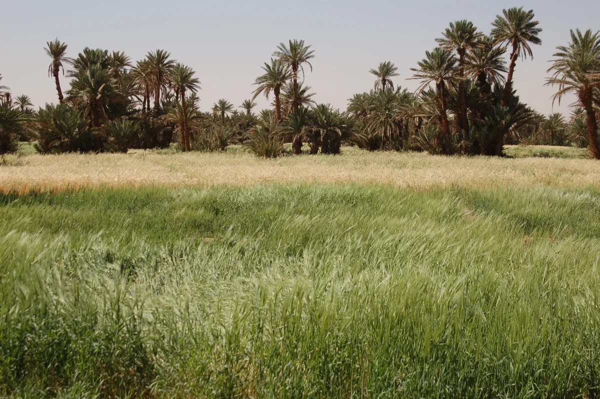

Agriculture is central to the wider oasis region. UNESCO’s account of the southern Moroccan oases identifies dates and other crops as important to local livelihoods, alongside the ecological value of oasis systems. That is regional context, not a crop inventory for every village around M’Hamid.
The photograph above makes that agricultural landscape tangible. Taken in M’Hamid in 2009, it records grain fields beside palms. There is both open, cultivated ground and taller vegetation: a different scene from the dune landscape on the cover.
Water connects the two views. A 2016 study of Middle Drâa water supply describes a regional farming system with cereals, dates, fodder crops and vegetables. Farmers adjusted the extent of cultivated land to the water available, while groundwater provided irrigation during shortages. These are descriptions from the study period, not a current inventory of M’Hamid’s farms.
The oasis is therefore more than vegetation surviving beside the desert. It is also land put to use, crops selected and water distributed. Understanding those relationships helps explain why changes in water supply affect the whole landscape.
Reading the settlements
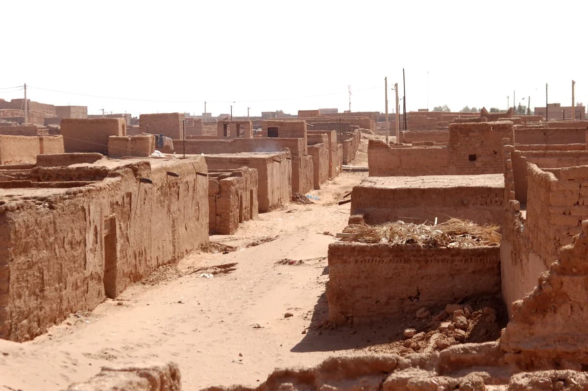

The International Nomads Festival’s description of M’Hamid distinguishes M’Hamid Bali, the old settlement, from M’Hamid Jdid, the newer centre. It also describes buildings made with earth or clay bricks. These details give a first orientation, not a complete architectural history.
In the street photograph, earth-coloured buildings stand close together, with walls and openings defining a passage through the settlement. The visible fabric is part of M’Hamid’s story, although a photograph cannot establish the age of an individual building.
There are useful differences of scale to keep in mind. A street belongs to a settlement; a settlement belongs to the wider oasis. The regional term ksour, used in Joudour Sahara’s documentation for villages, points to that community scale. It is not a label for every wall or building.
Earthen architecture also has a contemporary chapter. The Holcim Foundation’s Joudour Sahara project documentation describes courtyards, shaded outdoor areas and naturally ventilated spaces. Its design connects places for music and gathering with responses to heat and sand. These are documented design strategies, not a claim that every planned facility is complete.
A history of connections
M’Hamid’s history reaches beyond tourism. The festival’s local introduction identifies its territory as a stop for trans-Saharan traders. The oasis belonged to connections extending beyond the valley, as well as to the life of its settlements.
Detailed histories of particular tribes, families and routes need separate, attributed accounts. No exact founding date is established here.
Listen for a living culture
Music offers a specific route into the region’s cultural life. In its documentation of southern Drâa traditions, Joudour Sahara associates Rokba with village gatherings and poetic passages that carry oral histories. It names Ksar Talha and Ksar M’Hamid El Ghizlane among places where the tradition is performed.
The project also documents Chamra in connection with Aarib nomadic traditions. Its work includes recording, practice and transmission to younger people. Music is something people learn and pass on, not only a trace of the past.
For a first encounter, begin with a named tradition and its documented context. That is more useful than treating one performance as representative of everyone in the oasis.
Water and a changing landscape
Environmental change belongs in any introduction to M’Hamid. In a 2017 study of vegetation in the oasis, Atman Ait Lamqadem, Hafid Saber and Abdelmejid Rahimi analysed Landsat imagery from 1984 to 2016, together with other data and fieldwork. They discussed drought, water management, land use and sand encroachment as interacting pressures.
The water system extends upstream. The 2016 water-supply study describes irrigation supported by releases from the Mansour Eddahbi reservoir and by groundwater. Riverbed infiltration and water used in irrigation contribute to aquifer recharge. In that connected system, rainfall, storage, distribution and farming choices all matter; local conditions cannot be explained by the presence or absence of rain at M’Hamid alone.
UNESCO’s photographic essay on Moroccan oases gives wider context through documented accounts of drought, silting and changing agricultural landscapes. Its examples include other oases; they must not be relabelled as M’Hamid.
These accounts show why the oasis should not be treated as a permanent green backdrop. Water and sand influence what can be grown and maintained. The studies are historical evidence, however: this article makes no claim about the current water table, crop area or rate of vegetation loss. Those require recent local measurements.
A few words to keep beside the map
- Oasis: here, the cultivated and inhabited landscape discussed alongside the surrounding arid terrain, not just the palms visible in a photograph.
- Ksar / ksour: village / villages in the terminology used by Joudour Sahara’s regional documentation. Check each place’s local name before assigning a label.
- Drâa / Draa: spellings used for the river and valley in the sources linked above.
- Oral testimony: an attributed account shared by a person. It is evidence of that account, not automatic confirmation of every historical detail it contains.
Continue with a place, a person or a question
Let the next step be small. Choose a settlement to learn about, a musical tradition to listen to, or a question about cultivated land. Follow the evidence closely enough that people and places remain distinct.
The next entries planned for this guide are a locally checked village directory, an introduction to the desert landscape, and a resident interview. They are not yet linked here as finished articles. Together, they can connect this broad introduction to particular places, local knowledge and attributed memories.
Editorial note
This research-based draft is attributed to the NomadeTrip editorial project, not to an invented local expert. It uses public institutional, research and community sources, checked on 20 October 2026. No quotations, interviews or personal travel experiences have been invented. The photographs retain their creators’ credits and original dates.
Before publication, a named human editor should take responsibility for the text and invite local review of settlement names and cultural descriptions. Contributors should approve the use of their names, photographs and testimony. Corrections should remain visible when they materially change an account.